Table of Contents
Introduction
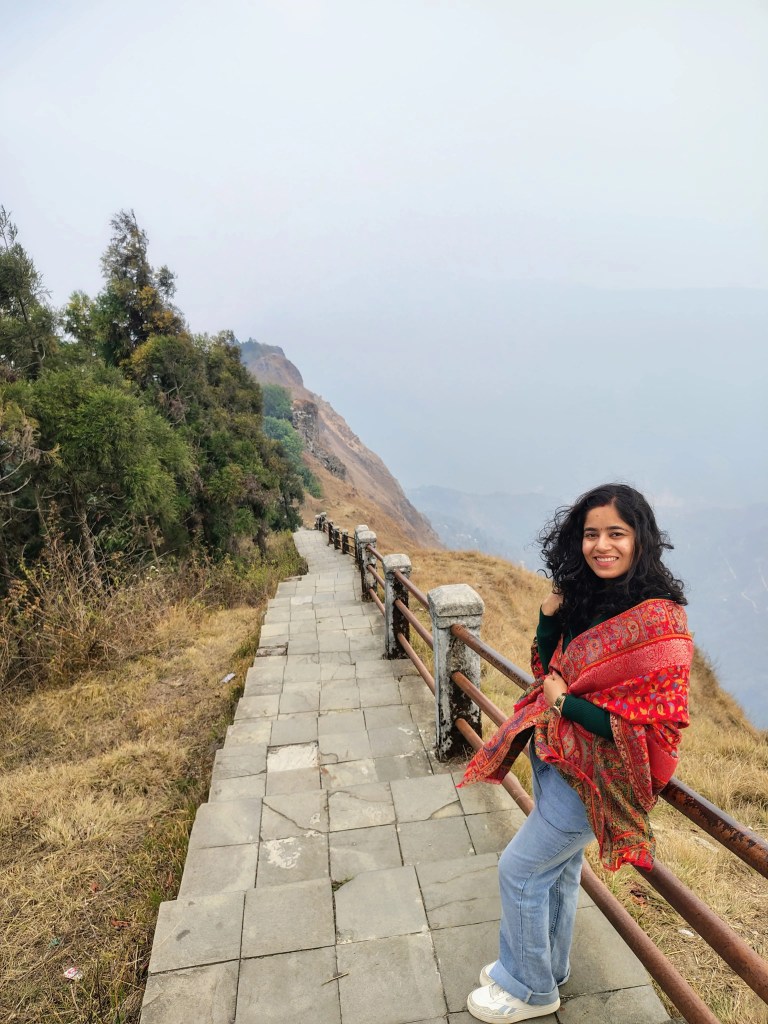
The ridge lines of Mussoorie have long been celebrated for their panoramic views of the snow-capped Garhwal Himalayas and the sprawling Doon Valley below. Yet, high on the western spur of Hathipaon sits a patch of land that represents far more than a scenic tourist viewpoint. The Park Estate, positioned at an altitude of approximately 2,000 metres (6,561 feet), was once the scientific epicentre of the British Empire’s mapping ambitions in Asia.
Following a meticulous government restoration and a subsequent management lease to a private enterprise, the property has been transformed into a modern repository of Himalayan cartographic history. To step onto this estate today is to confront the monumental physical and mathematical realities of the Great Trigonometrical Survey of India—a project described by historians as one of the most stupendous scientific undertakings in human history.
The Master Surveyor of Hathipaon: Sir George Everest’s 11 Years in Mussoorie

While the world’s highest mountain peak bears his surname, Colonel Sir George Everest (1790–1866) never actually laid eyes on Mount Everest. His legacy was cemented not by climbing peaks but by establishing the mathematical framework that allowed their heights to be calculated with pinpoint precision.
The Purchase of Park Estate (1833)
George Everest arrived in India at the age of sixteen as a cadet in the Bengal Artillery. Displaying a rare, innate talent for mathematics and astronomy, he was eventually appointed as the chief assistant to Colonel William Lambton, the founder of the Great Trigonometrical Survey (GTS). Upon Lambton’s death in 1823, Everest assumed control of the survey, and in 1830, he was named the Surveyor General of India.
Seeking a high-altitude base with unobstructed, clear sightlines across both the plains of northern India and the deep gorges of the Himalayas, Everest purchased the Park Estate in Mussoorie in May 1833. He bought the land from General Whish, establishing his permanent residence, personal observatory, and calculations laboratory on the site. For eleven long years, this estate served as the nerve centre for the triangulation grids that mapped the Indian subcontinent.
Measuring the Meridian Arc

Everest’s life obsession was the measurement of the great meridional arc of triangles running from Cape Comorin at the southernmost tip of India straight north to the Himalayan foothills—a staggering linear distance of roughly 2,400 kilometres (1,500 miles).
From his observatory at Hathipaon, alongside the nearby terminal station at Banog Peak, Everest ran the final, critical northern sections of this arc in Mussoorie, Uttarakhand. The primary purpose was not just making regional maps but determining the exact shape and curvature of the Earth through geodetic measurement. At this high elevation, away from the dust and thermal distortions of the plains, his massive telescopes could capture distant visual targets positioned dozens of kilometres away across the mountain gaps.
The Colossal Engineering of the Great Trigonometrical Survey

The artefacts housed within the newly restored Mussoorie museum reveal the brutal physical toll of nineteenth-century cartography. Before the advent of satellite imagery, radar, or GPS, mapping an entire subcontinent required moving thousands of pounds of fragile scientific glass and iron across dense jungles, swift rivers, and sheer alpine cliffs.
The Great Cary Theodolite
The centrepiece of early survey operations was the legendary 36-inch Cary theodolite. A precision instrument used for measuring horizontal and vertical angles, this massive piece of brass and iron weighed over one thousand pounds (approx. 450 kg).
Transporting this fragile instrument required a massive logistical caravan. A standard survey expedition led by Everest typically included the following.
- 4 Elephants for navigating tiger-populated tall grasses and transporting senior officers.
- 30 horses for military personnel and scouts.
- 42 camels dedicated entirely to hauling delicate machinery and heavy equipment camps.
- 700 to 800 porter labourers who carried the massive theodolites, chains, and tents on foot up steep mountain tracks.
The Cary theodolite was so heavy and delicate that it had been dropped and severely damaged twice in its history, requiring meticulous, manual on-site repairs by the survey’s master mathematical instrument maker, Henry Barrow. To take readings, these enormous instruments had to be hoisted manually up 50-foot-tall stone masonry towers designed by Everest to clear the forest canopy.
The Colby Compensating Bars and Dehradun Baseline
To anchor an entire country’s worth of triangles, surveyors needed an incredibly precise starting line of known distance. In 1831, Everest oversaw the measurement of the Dehradun Baseline, a flat tract of land in the Doon Valley measuring roughly 39,183 feet (approx. 7.4 miles).
To eliminate errors caused by metal expanding and contracting in the intense Indian heat, Everest imported the Colby compensating bars from England. These were specialised compound bars made of brass and iron joined together in a way that kept their total length completely constant regardless of temperature changes. The Dehradun baseline was measured so perfectly using these bars that when it was later checked against a baseline hundreds of miles away in Sironj via a massive grid of triangles, the mathematical calculation error was less than several inches.
The Closed Frontier: The Geopolitical Standoff Over Tibet
By the mid-1800s, British surveyors had successfully mapped the plains of India up to the foothills of the Himalayas. However, the vast, mysterious plateau of Tibet remained an absolute blank space on global maps.
The Qing Exclusion Policy
Under the strict rule of the Qing Dynasty and the spiritual governance of Lhasa, Tibet shut its borders entirely to all Westerners and European empires. The authorities recognised that mapmaking was often the precursor to imperial invasion.
Consequently, any foreigner caught stepping across the Tibetan border faced immediate imprisonment or execution. The British East India Company, and later the British Crown, found themselves completely blocked from exploring the trade routes, rivers, and high mountain passes of the trans-Himalayan frontier.
The Birth of the Pundit Project
Realising that white British officers could never cross the border undetected, Captain Thomas Montgomerie of the Survey of India devised a daring, highly secretive intelligence programme in the 1860s. He proposed training indigenous highlanders from the border districts of Uttarakhand and Himachal Pradesh to act as deep-cover mapping spies.
Known officially in survey logs as “The Pundits”, these men were highly educated, physically resilient individuals who could blend in seamlessly with regional trade caravans and religious pilgrims. They were brought to the survey headquarters in Dehradun and trained in advanced geometry, astronomy, and covert navigation.
The Secret Walkers of Kumaon: Turning Bodies into Surveying Tools
Among the most brilliant operations conducted under the Pundit project were those executed by two cousins belonging to the Shauka community of the Johar Valley in Kumaon, Uttarakhand: Nain Singh Rawat and Kishan Singh Rawat. To survive their missions, they had to completely abandon heavy brass theodolites and iron chains, turning their own bodies into living, walking scientific tools.
The Mathematics of the Human Stride
Before setting foot across the high passes into Tibet, Nain Singh underwent months of rigorous training within the enclosed survey gardens of Dehradun. He practised walking for miles at an absolutely unvarying, mechanical pace.
No matter if he was navigating flat ground, wading through mud, or climbing up a steep, icy mountain pass at 15,000 feet, his single stride was trained to measure exactly 31.5 inches. Every single step he took for years was a fixed unit of mathematical measurement.
Modifying the Buddhist Mala and Prayer Wheel

To count their steps without drawing suspicion from suspicious border guards, the Pundits completely re-engineered traditional Buddhist religious items:
The Modified Mala (Rosary): A traditional Buddhist rosary contains 108 beads. The Survey of India carefully modified Nain Singh’s mala to contain exactly 100 beads. As he walked across Tibet, he would slide one bead down for every 100 double paces. When he reached the end of the 100 beads, he knew he had walked exactly 10,000 paces, which correlated directly to a specific fraction of a mile.
The Secret Prayer Wheel: The handheld prayer wheel (*Mani Chhorlo*) carried by Nain Singh did not contain holy mantras or religious scrolls. Instead, inside the hollow brass cylinder, he hid narrow, blank slips of paper. Every evening, he would slip out these papers to log his daily step counts and compass orientations, recording the geography of forbidden lands.
Hypsometry and the Boiling Point of Water
Determining altitude without carrying massive barometers was another incredible challenge. The pundits used the scientific principle of hypsometry: the boiling point of water changes based on atmospheric pressure, which drops predictably as elevation increases.
Every night, under the guise of preparing tea or cooking meals, Nain Singh and Kishan Singh would boil water in remote camps. They used hidden, high-precision pocket thermometers to record the exact temperature at which the water boiled. By cross-referencing these temperatures against a mathematical scale calibrated by the Survey of India, they were able to calculate the elevation of Tibetan mountain passes and plateaus within a few feet of accuracy.
The 3,000-Mile Legacy of the Rawat Cousins
In 1865, Nain Singh successfully infiltrated Tibet disguised as a Ladakhi trader. He walked all the way to the forbidden capital of Lhasa, mapping the course of the massive Tsangpo River (which was later proven to be the Brahmaputra) and fixing the exact geographical coordinates of Lhasa for the absolute first time in world history.
Years later, his cousin Kishan Singh Rawat undertook an even more gruelling four-year journey. He walked an astonishing 3,000 miles across Tibet, mapping deep into the Taklamakan Desert and across the rugged terrain into Mongolia. Despite surviving violent blizzards, freezing temperatures, and being robbed of nearly all their food and clothing by bandits, both cousins kept their secret logs intact. When their hidden journals were smuggled back to Dehradun and plotted against European maps, their calculations proved to be staggeringly accurate.
The historic legacy preserved on the heights of Mussoorie reminds us that while European colonial names might dominate the peaks on our maps, the actual mapping of these mountains was earned through the silent, heroic steps of the highlanders of Uttarakhand.

What is George Everest Mussoorie famous for?
George Everest House is famous for its connection with Sir George Everest, the former Surveyor General of India. Built in 1832, the house served as his home, observatory and laboratory. Today, it is known for its rich history, Himalayan views, Doon Valley scenery and scenic hiking trails.
How long is the George Everest hike in Mussoorie?
For the commonly used trail from Park Estate, allow roughly 1 hours for the uphill walk, depending on your pace and conditions. A complete visit, including the return journey and time at the viewpoint, generally takes around 2-3 hours.
What is the entry fee for George Everest?
The entry fee for George Everest is approx around ₹200 per person. However, fees may change, so it is advisable to check the latest charges before visiting.
How do I go to George Everest from Mussoorie?
It is located about 5 to 6 km from Gandhi Chowk (Library Bazaar) in central Mussoorie. You can easily reach it by hiring a local taxi or driving your own private vehicle (car/two-wheeler)
What is the height of George Everest Mussoorie?
Approx. 2,000–2,300 metres above sea level
How far is George Everest from Mussoorie Mall Road?
It is located about 5 to 6 km from Gandhi Chowk (Library Bazaar) in central Mussoorie. You can easily reach it by hiring a local taxi or driving your own private vehicle (car/two-wheeler).
What is the history of George Everest Mussoorie?
Sir George Everest was a distinguished British surveyor and geographer who served as the Surveyor General of India from 1830 to 1843. He played a pivotal role in completing the Great Trigonometrical Survey of India, establishing high-precision mathematical frameworks that accurately mapped the entire subcontinent.
What are the directions to George Everest Mussoorie?
From Mall Road / Library Chowk in central Mussoorie, head west onto the Hathipaon Road. Follow the winding scenic road toward Hathipaon for about 5 to 6 km. Once you reach the Hathipaon junction, follow the signboards leading directly up to the Park Estate / George Everest House parking area.
What are the George Everest Mussoorie timings?
George Everest House timings as 9:00 AM to 6:00 PM.
Is George Everest worth visiting?
Yes, George Everest is definitely worth visiting if you enjoy history, mountain views and scenic hikes. The historic estate, peaceful surroundings and panoramic views of the Doon Valley and Himalayas make it a refreshing escape from the busier attractions of central Mussoorie.


Leave a Reply